Story continued from: Part 14 - The Lost Coast Trail - Rattlesnake Ridge - Belly of the Beast!
1924 was the last time a Grizzly bear was ever seen in California. They had been hunted to extinction. Some of the bears in the state weighed over a ton and were often observed in bloody conflict with other animals for supremacy of the land. California even became known as the Bear Republic with a grizzly bear (Brown Bear) adorning the state flag. Something this wild and pure in its essence is now gone by the folly of man. Really sad when you think about it. All that is left is the phantom symbol on the flag, and the black bears - still a threat to us hikers - but they don't have the take no bullshit attitude of the Grizzly.
We were still a bit nervous staying at Bear Hollow Camp for the night because the trail leading up to the camp was covered with piles of scat from the bears that lived up in these hills. There were lots of berries and plants to eat along the trail so we thought at any moment we would encounter a bear sitting on its ass, deep in thought as to whether the light green berries from this plant are more sublime than the blue colored berries from that plant. Another added lure, the camp was the only game in town with regard to water on the mountain...we knew there would be visitors that night. As a result, we circled the wagons by setting up our tents in close proximity to one another. We also kept an eye on each other as we went for water from the spring pipe at the far end of camp. It was just like Clint Eastwood and Sondra Locke in The Gauntlet - one of us might not come back.
 |
| Circling the wagons - Bear Hollow - this makes it look like we brought a ton of stuff. |
 |
| Douglas Firs over camp |
 |
| Shubrick Peak - right (2797ft) |
After the routines of cleaning up from dinner and relaxing a bit, we all turned in. The hollow where the camp was located kept it low and away from the breezes running up mountain. But the tall Douglas firs above the camp caught the wind and mimicked the sound of the ocean surf much like a seashell does; it was very nice.
The damage from my shoes being filled with water was evident in the morning. I had a very large open blister on my heel that had dried to a drippy amber-like consistency. My camp shoes were flip-flops which were great for getting air to my feet. As I sat there, yellow jackets decided to gather and tug at the puss that was hardening on my heel. Oddly it was a somewhat pleasant sensation and I watched them with great interest. They were doing a good job cleaning it up. I wonder if I can setup a spa in Hollywood with this service - maybe for plastic surgery patients. It is not too far off from people soaking their feet in water tubs filled with Garra rufa - the doctor fish. See, with my idea...that is why I am not a successful business man.
 |
| Erosion Problem |
 |
| Climb to the ridge - switchbacks are subtly visible in bushes up to the left. |
 |
| Looking back to Bear Hollow - under the fir trees. |
 |
| Amazing view to the Northeast from the ridge. |
 |
| Whitey at the ridge |
 |
| Whitey and Flyrod - Kings Peak to the far right. |
 |
| Easy hiking on the ridge to Kings Peak |
Today we planned to have lunch atop Kings Peak. It was only about 3.5 miles away but a tough distance. We had another 1300ft vertical we needed to scale. The long day yesterday and the hard push at the end had us moving a bit slow. My left knee had also started to act up. Prior to this hike, I had a bad fall on a training hike a few weeks earlier. The Appalachian Trail near my home in Virginia is rife with rocks that always seem to catch me out when I get tired or don't pay attention. It was a hard impact to the knee and now it was swollen and stiff.
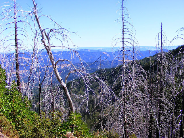
It was a steady climb up the rest of Rattlesnake Ridge to King Crest Trail. This trail followed the ridge line over to Kings Peak and had fantastic views into the valley to the east and the ocean to the west.
 |
| Switchbacks to top of Kings Peak |
|
|
 |
| Miller Flat below - long way down |
 |
| Wind, current and inversion layers offshore. |
 |
| Me and my tuna on a pita - ahhh!! |


No comments:
Post a Comment