Saturday, September 24, 2011

Part 1 - The Lost Coast Trail - Petrolia Calling

Sometime during the fall of 2010 I announced that I was going to California to do some backpacking. I said it to my crony’s at the Old Brogue in Great Falls, VA over probably my third imperial pint of Guinness.  To be honest, I really had no idea what I was talking about. I didn’t have a backpack nor did I really have a clue as to what was involved.  I heard they have internal frame packs now - what the heck is that?  The last time I had backpacked was the summer before the 7th grade with my sister in Montana – where we lived at the time.  My dad did all the expedition provisioning so I was sheltered from the hard core decision making – my only input was that I liked the yellow backpack.  Little did I know it would ultimately weigh 35lbs for an overnight trip and I at the time maybe weighed 90 pounds.  This time it was my chance to do something life changing - plan and provision the trip myself.  Also - to make it more memorable, I was actually hell bent on doing the trip alone into the wilds of Northern California – maybe getting in touch with my chi. It had to be the beer talking, but I was going no matter what. 

Petrolia is at the very top - where the fault heads out to sea
I had recently read a book that was the genesis of my new found wanderlust.  Like any well written book, this book had the ability to transport me from the soft furnishings of my home to the hard won life of Northern California.  And like all good expeditions, or fires if you will,  they start from a single spark.   This book, and I highly recommend it, was written by Simon Winchester – a seemingly very high brow Brit who uses lots of complex multi-syllable words I call – SAT words – due to the words actually never being spoken in a real conversation over coffee, they just exist on the college entrance tests.  Anyhow – the book was called “A Crack in the Edge of the World – America and the Great California Earthquake of 1906." 

What I found so interesting about the story was to think that all these people, the dreamers, the forty-niners looking for gold, or people just looking for a new start in life, were essentially doomed because the location they decided to setup shop was on perhaps the most notorious earthquake fault in the world – the San Andreas. Of course nobody had heard of this fault yet.  But it was there - hiding in plain view.  The formation of the San Francisco Bay, and the idyllic landscape around the Bay area, can be attributed to this colossal tear in the Earth’s crust.  The Pacific tectonic plate was moving North and the North American plate was moving south.  Kind of like a couple arguing with no end.  All this is interesting to be sure, but what really stoked my interest was the mention of a small tumble down town 250 miles North of San Francisco called Petrolia. This little town, situated five miles from the Pacific ocean had two distinct items of notoriety - the first being where California discovered oil (soon dried up), the second being that it has the most earthquakes of any town in the United States.  I just had to go there.

With the advent of Wikipedia I easily found an entry for Petrolia, CA and took great interest in all that had to do with this little town.  It really was just a pony stop of a place. It was located on the edge of the Mattole river that flowed most of the year quietly into the Pacific. It had a Post Office, general store, gas station and not much else. Like a celebrity stalker following someone on Twitter, I looked up the Northern California Earthquake map on USGS and had fun watching the tremors shake the little town nearly every day. I would announce to my wife at breakfast that there had been two earthquakes in Petrolia the day before. Quite naturally the lovely Mrs. Corrigall would elicit some form of enthusiastic response and I would go on saying how cool it must be to have your house shake each day. 
 
You see from the picture on the left, each dot representing an earthquake, I don't suspect the people in Petrolia keep much fine china in high places where it could fall and break.  And urns filled with your great uncle's ashes are best kept low with the lids taped shut.  Even the name for Petrolia, CA on the map is not visible under the onslaught of tremors.  This is all caused by the coming together of three large faults - or plates in the earth near this quaint little town.  This is the Mendicino Triple Junction. - Pacific Plate sliding North on the left, the Gorda Plate coming South and the North American plate moving South too.  What a hot mess.  But it makes for interesting conversation when the dinner table moves and you think it is your Great Dane shifting to lick something; only you see your Dane looking forlornly in the front window as the table moves across the floor.  How cool would that be?
Naturally you did not come to this blog to read about earthquakes and plates or the safety of Great uncle Willard's ashes stored on the high shelf above the door.  If you wanted to learn about quakes and tectonics you would have stayed in Mr. David's Earth Science class instead of skipping out and heading to McDonalds before they changed over for lunch - I love Egg McMuffins.  You came to read about my adventures in the wilds of Northern California.  In the land known as the Lost Coast.  I assure you the journey is ahead.  With all the tears and discovery that I was hoping to pull from my fragile body and mind.
This is an incredible landscape we are stewards of, and the escape it brings is one you will enjoy.


Part 2 - The Lost Coast Trail - What is Lost is Found

START HERE - LOST COAST PART 1


The problems presented with life in the small town of Petrolia, CA (Part 1) dictated largely what this area would become in the future.  People oddly don’t like to have the ground moving or shaking underfoot.  Buildings and highways and the other flotsam that mankind seems to bring wherever we go don’t stand up too well to this kind of activity either.
End of Highway US 1 - over the hood of Whitey's hot rod 2011 Nissan Versa
When California was building highway US 1 up the coastline it was certainly a challenge in the lower half of the state.  There are lots of cliffs and canyons, erosion and landslides, earthquakes and ocean waves that all had to be conquered as man seems obsessed with doing – perhaps part of the notion of Manifest Destiny.  They did it naturally, but at great cost and continuing cost as these elements persist each day at tearing down what was built.  When the builders covered the 600 miles up from the South and got to Rockport, CA, some 200 miles north of San Francisco – enough was enough.  It was like the bad relationship that you keep hoping will get better and it doesn’t.  Perhaps this is where the expression was coined and affectionately applied to discarded girlfriends, “That bitch was a bad piece of road”.  So the bad piece of road was turned inland to join US highway 101, away from the very rugged coastline that lay ahead.
Since modern man does not generally venture too far from their cars, 150 feet I read somewhere, and kids today see, if they are even looking, national parks through the food smeared windows of their air-conditioned mini-van, this area without a road is essentially lost to the general public.  It was dubbed the Lost Coast – and I am glad it was found by me. 
If you look on a map of California, you will see a prominent bulge near its border with Oregon – Cape Mendocino - between Eureka and Fort Bragg - this is the Lost Coast.  Plastic surgeons have rhinoplastied smaller bulges than this on spoiled sixteen year old girls.   Since I was afraid of being sequestered in a car myself, food on windows withstanding, I was wondering how I was going to spend any quality time visiting Petrolia and this lost shook-up world.  That is when I discovered the Lost CoastTrail.   Now this is a hike I could do.  It starts at the beach where the Mattole river enters the blue Pacific ocean and heads down the coast to Shelter Cove, CA some 25 miles distant.  Perfect – I can visit the town I have been stalking and take a nice walk along the beach listening to the surf and look at seashells.  What is this you say?  There are lions(sea), bears, rogue waves, snakes, skunks, pot growers and other forms of life altering beings that I may meet?  Bring it on!! 
Mattole Beach - the Mattole River enters just before first hill -9-18-2011
        Being a man of a certain age (I really love that line – a nice way to say mid-life crisis), I think we look at ourselves for something in life that reassures us that we are still the virile (not viral as some men probably are at this age) man our wives were once oddly attracted to; one last chance to be the man we want to be or thought we were.  I didn’t need a young twenty year old girlfriend for that; I wouldn’t know what to do with one if I had one…well.  Besides she would never get my '80s movie references.  I already have the cool red sports car – had it since I was 4 (pre-school crisis).  But also for the last ten years at work I felt like I was driving with my eyes closed.  I was getting called in the middle of the night for operational issues, I was not happy with my job or the changed corporate culture, or even where the company was heading.  Sadly I didn’t have the confidence or courage to quit.  So this looked like it could recharge the batteries that seemed to have lost their ability to hold a charge.  Maybe give me the push I needed to make a change in my life.
To be honest though, thinking of camping alone in the wilderness, 3000 miles from home, with bears and Bigfoot, would sometimes wake me up at night.  I would lie awake staring up at the clock we have that projects time and temperature on the ceiling, wondering how I would ever be able to do it.  How would I get this clock to work in my tent?
See – Part 3 -The LostCoast of California – Family Connection


Part 3 - The Lost Coast Trail - Family Connection

START HERE - LOST COAST PART 1

The Lost Coast trail I was planning to hike (Part 2) lies in the King Range Conservation Area (This area recently had over 42,000 acres designated as Wilderness by the Northern California Coastal Wild Heritage Wilderness Act of 2006).  All the land in the King Range is under the control of the Department of the Interior – Bureau of Land Management (BLM) Arcata, CA office.  They are responsible for managing the entire expanse of some 68,000+ acres.  They can provide up to date trail conditions, great topo maps, tide timetables, and answers to any questions you have regarding the area. They should be your first call if you are planning a trip.

I found the tide timetable book especially entertaining and important, if not disconcerting, as there are areas on the trail where you will need to time your crossing to avoid being sweep out to sea by a rogue wave (It has happened).   I can only imagine the horrors they might experience down the coast at Pebble Beach if some backpack wearing, half-eaten Lost Coast hiker floated up at the 18th hole.


Palos Verdes - Portuguese Bend at Sunset
A few more miles down the coastline is where I grew up - initially in Riverside, CA and then Palos Verdes, CA – they call it Rancho Palos Verdes now.  It was and is apparently a very well to do area of Los Angeles – I had no clue at the time.  It juts out on a steeply walled peninsula into the Pacific Ocean.  In such a utopia, the kids in my neighborhood ran wild from sunup to sundown without any ‘perceived’ adult supervision. The only time a parent came into the picture was for meal disbursement and first aid – both required by the LA County Child Protective Services. Aside from that you were on your own. Interestingly I heard just yesterday, that a woman in NYC is getting paid $350 a session to bring kids to Central Park and leave them there unsupervised for pick up later – they call it Free Range Parenting – look it up!  So yes, we had it good back then – we were free range kids.

As with other typical life patterns of the ‘60s and ‘70s, my mother could be found at Mrs. Bails house having cocktails with the other neighborhood wives in the afternoon until the husbands came home in their usual gruff.  Mom has an outwardly adventurous spirit and never turns down fun – she took up SCUBA diving and would often go disappearing into the surf at the beach with her dive buddy Linda and reappear like sea monsters forty minutes later with tales of life below the waves.   We kids would just ride the waves, float out past the breakers, and watch the smooth contoured backs of the waves rolling in as we drifted north toward Torrance beach. Sometimes we would see who could touch the bottom. We would slip off the rafts, take a few deep breaths and dive down and down until our ears hurt, we ran out of breath, or got too cold. I don’t think we were ever scared (The beauty of pre-JAWs days).  And nobody ever touched the bottom. My mom later informed me it goes down about a mile on the way to Catalina Island – good luck with that.

BLM, as mentioned earlier is actually a household name for me. My father worked for BLM when I was first born in CA and then later on in his career just before and after his unexpected return from a two-year BLM assignment with USAID in Indonesia. When he was in Jakarta he suffered a near life ending brain aneurism at the age of 48. After transport to Singapore and ultimately Canada for surgery, he had a long recovery that took a lot out of him. I had just completed high school so I really only saw him during the summers and breaks from college. He seemed lost and depressed and having a tough go of it – he would sit holding his head on the front porch and not say much. But he got up each day, bad headaches and all, and went off to BLM in Washington, DC.

Being self-absorbed as young people tend to be at that age, I would still notice him at night, reading and working on unknown things (boring office stuff I thought) in his chair while my mother dozed off to Magnum PI on the couch. I never really learned what he was doing or did at that time - we just were never very communicative.  He was a very accomplished and brilliant man with a Masters of Economics from Michigan State.  But oddly enough, and a surprise to me, in Palos Verdes he coached my AYSO soccer team, the Coyotes, to a fantastically miserable 1-10 season. I think he felt his superior intellect could somehow outsmart and out-strategize the more archetype ‘mouth-breather’ coaches of the other teams. But he tried and I thank him for that.

He ultimately moved up the ranks as I got on with my own life. He was put in charge of a new branch of BLM called the Wilderness Resources. This is where he shined. As Chief of this office he had incredible responsibilities; he was a land baron with over 5 million acres. My mom tells me he would sometimes get calls in the night from distant BLM field offices saying the wilderness area was on fire – “What should we do?” ----- Dad - "Natural cause or camper?” ----- “Lightning” -----Dad - “Let it burn.”

Also part of the job was to look at land in the BLM system and deem whether it could or should be designated as wilderness. This often was met with a lot of controversy and push back from the people that have been using these lands. It would mean no more mountain biking, ATV trails, 4 wheel drive roads, or possible cattle grazing.   People often feel that government land should always be available to them since they are paying for it. But the Wilderness Act of 1964 said it best:
 “A wilderness, in contrast with those areas where man and his own works dominate the landscape, is hereby recognized as an area where the earth and community of life are untrammeled by man, where man himself is a visitor who does not remain.”

Prior to my father retiring from his post, he submitted to Congress a list of BLM lands that he and his team felt should be designated as "Wilderness". The very land I had found so serendipitously – the Lost Coast – was on the list.  Thanks Dad!!!

Next - Part 4 - The Lost Coast of California - Expedition team

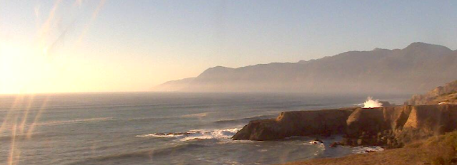
Tonight's Lost Coast Pic -  Inn of the Lost Coast Webcam

Part 4 - The Lost Coast Trail - Expedition Team

START HERE - LOST COAST PART 1

One of the funny things about this hike was that I wanted to hike it alone and in the end I had two buddies join me.  I would not change a thing.  It made for a fantastic trip - lots of laughter and pain.  The best though were the memories and shared experiences we will be able to reflect on later.  Since I originally told my wife I was going on this hike solo - I think from day one she secretly campaigned for friends to go with me.  She likes to keep asking me, "How will you do this?  You blister so easy."  It is true - I have the softest hands known to man.  I cannot build calluses.  Any rough skin after a manly day of working in the yard or working on the cars, will be miraculously turned to butter hands overnight.   Same for my feet - no calluses there either...odd yes?  So a bad idea to do this alone.

Whitey Camp Shoe

Anyway, I collected a couple of great expedition members when I spoke so highly of this trip.  It was nice to hear that what I thought would be cool, sounded cool to them.   The first member was my buddy Matt - or "Whitey" as we call him.  He is a true outdoors person.  He plans his vacation time around different backpacking trips, fishing trips, and other adventures that sound fun.  Often I would get obscure texts or emails on a Friday night in the middle of winter saying - "Hey, camping at Wolf Gap tonight - come on out."  So he never shrugged at this trip - thought it would be a blast.  Another thing about "Whitey" was that he dedicates an entire room of his house to expedition gear: tents, backpacks, sleeping pads and bags (+40, -10, bag liners), camp stoves, shoes, water filters, trekking poles, food stores (digs the freeze dried stuff on sale), lights, and his world traveling orange Crocs (you can see them on his pack below)...I could go on.   It is his base camp at home where he can plan what he will take.  Obviously he would be a good one to have on the trip - as I at this point had nothing I could use that was made in this century.  When he was over once I thought I saw my wife pass him a Benjamin - not sure. 
Mattole Beach - Matt -"Whitey" - Mike - "Flyrod" - Ian - "Jagman"
The next member of the Lost Coast crew was my brother in law, Mike.  His trail name is "Flyrod" ("Fish Breath" would have been good too, but it is already taken by another fishing buddy of mine Milt, and that is not really a good name anyway - conjures up some bad cringing images) since he is an avid fly fisherman - always ready to pull out his rod.  Sorry - deal with my childish humor.   He has the "River Runs Through It" casting rhythm down so well I would not be ashamed to say he was probably the technical director for Brad Pitt in the movie.  Mike, like me, needs all new gear as well; we have not been in the "bush" for some time.   My sister, Mona, the one I mentioned earlier whom I went backpacking in Montana with, is Mike's wife.  She, I can happily say, is supportive of his adventures knowing that he needs a break from the everyday.  Mike and I both work in the financial field, he in business development and I in financial system development.  Even Whitey is in the finance world - so we are all a bunch of numbers guys.  And I really suck in math - go figure.

One of the first stops was for Mike and I to hit REI to grab a "bit of kit" as the Brits say.  We needed packs, sleeping bags, water filter, stoves, and a bunch of the staff's help figuring out everything.  Great store - I highly recommend them.  It was also fun loading up my eventual purchase, the Gregory 65 pack, with 45lbs of weighted bean bags then wheeze about the store frightening the small children as they thought I would topple over from the weight.  We also needed Bear Canisters for our food and anything that smells too - toothpaste, soap, etc. These canisters are very hard for even people to open - but there is a bear in New York State that has figured out how to open some models.  "I am smarter than the average bear, Boo Boo."  Really though - these are for the bear's safety as much as ours.  You are required to use them on the Lost Coast trail.

With great fanfare, Whitey, Flyrod and I met one Saturday morning over coffee and poured over the topo maps, calendars, and tide charts to figure out our schedule and route; we were going in September, between the sometimes fog of Summer and the heavy rains that start in October.  We pulled out other items of interest - headlamps, stoves, etc.  Then Whitey whipped out a very large knife to the concern of the latte drinking patrons when Mike asked him what kind of knife he should bring.  I wished I had a machete or something to add to the mix.  We could have taken that store!!

Next - Part 5 - The Lost Coast of California - Westward Bound! 

Tonight's Lost Coast Pic - Inn of the Lost Coast Webcam


Part 5 - The Lost Coast Trail - Westward Bound!

Sunrise heading to San Francisco - love this pic

START HERE - LOST COAST PART 1

Continued from Part 4......

"Go West, young man," was once said.  Perhaps to a man without other options or who had to get someplace big and vast and away from the father of the young lady he took a few liberties with.  Either way, that is where I was headed.  To the land of my birth - California.  To me, there is something very intrinsic about returning to where you are from.  The land, the air, the sky; they align with the elements that make up your being.  Perhaps there exists an inner compass that these elements suddenly feel a pull toward - like salmon finding their river of birth.  Are we humans so conceited we feel that this force can not exist within us?  I don't think so, but enough philosophy, I was westbound - Californication!!

Ironically too, a month before leaving for California, the land of earthquakes, Virginia was struck with the most powerful quake East of the Mississippi since 1897.  A 5.8 magnitude rumbler shook virtually the entire east coast.  The Washington Monument was damaged along with the National Cathedral - winged gargoyles fell from the sky.  Even a nuclear power plant in Virginia shut down from the shaking.  And here I was heading West - to the San Andreas Fault line - the irony was so pure.  Funnier still, I was planing to sleep in my tent that night.  My neighbors probably thought I was afraid to sleep inside..hey, I had to check my gear out!


Cold outside - at +40, my sleeping bag would come up a bit short
When the quake hit, I was chatting with a co-worker in front of my office building.  It was such a gorgeous day - earthquake weather - and it initially seemed as if a large truck was careening out of control down the street.  The awning in front of the building was moving back and forth and the windows were trying to pop themselves free of their frames.  We both ran clear just as the shaking came to a halt.  We waited in wonder as the building disgorged our co-workers - we got to go home early that day!  It was so cool!!!

As I flew to San Francisco, I looked out the window at the land below.  The West seemed so infinite that day; exposing to me its raw beauty.  Unlike the East coast, the western lands show more texture, colors and scars from the life they have lived.  From this elevation, there are signs of mighty ghost rivers that once cut the land, leaving fissures like wrinkles and haunted river valleys barren of past life.  The arid land is continually sculpted by water and wind and as would be expected, water seems to be the most important element.  It was over Utah that I could see the striving exploitation of the land. Melt-off from snow that falls upon a shallow peak is captured into irrigation ditches and channeled into sprinklers that fed three large circular green swaths that stand out like errant drops of paint on a grey-brown terrazzo floor; it was striking in contrast. 

Yosemite Valley - Half Dome at top.
We flew over Yosemite before descending toward the Bay area.  If you are lucky and the plane is low enough you can make out the Yosemite valley that is guarded by the great half dome mountain that Ansel Adams made so famous with his pictures. I still have yet to visit this gorgeous park - it is on my list.

When I landed and collected my duffle bag, I took a seat and waited for Flyrod's flight to arrive - Whitey had arrived the prior day and headed up coast on his own.  An entry in my journal indicated I was very excited about the hike and made a comment that I knew nothing about what was in store - so true.  I then relaxed and looked around at everyone with an odd sense of pride.  I had come West, this was my state and I felt that I could tell them, the "tourists", about things they should know - about the scents and sounds in the air, and the way the sun hangs in the sky at a different angle.  How all this can align your elements if you pause to let it.

Tonight's Inn of the Lost Coast Web Cam picture - look at the huge wave that just exploded on the rocks off Black Sands Beach - fantastic!!

Part 6 - The Lost Coast of California - Rental Cars, Convicts and Hippie Chicks

Part 6 - The Lost Coast Trail - Rental Cars, Convicts, and Hippie Chicks

START HERE - LOST COAST PART 1

continued  from PART 5 .....
Rental cars to me are the most noble of all automobiles.  They are the ultimate disposable appliance - a true people's car (volkswagen).  If you buy the insurance then you don’t have to worry about damage of any sort.  You don’t have to schedule their oil changes or other maintenance.  The tires can be shredded like a stuffed animal in a puppy's mouth.  You don’t care where you park it.   They are in essence the perfect care free solution for getting around – just add the hamburger behind the wheel.
San Francisco Bridge to Marin County
The car Flyrod and I picked up was a real screamer – a 2011 Kia Forte.  Whitey picked up a 2011 Nissan Versa.  Both of these cars are market competitors.  The market being thirty-something men who live at home with their parents, but don’t want to buy anything too flashy that may tip off that they are doing pretty good with the free rent deal.  In short, four doors, front-wheel drive, 107hp under the hood (Nissan), a whopping 154hp for the twin-cammer Kia Forte, and as exciting to drive as a shopping cart with a bad pull to the left.   I did not drive the Nissan, but I can tell you the Forte was the most predictable car in the world to drive.  If you exceed the speed limit around a corner, the car will continue to go straight when you turn (Push for NASCAR boys, Understeer for everyone else).  Adding more power will only increase the screaming of your tires and passenger.  In the end though, it proved to be a great car to flog about on the twisty roads of the North Coast.   Flick the wheel hard before the turn – get the tires pointing where you wanted to go – then add power to drag the back end around.  You can then make some quick time.  The six speed auto trans had a nice “manual” gate that let me shift when I wanted.  It was great fun and something to remember when I move back home.
A tall caramel mocha skinny please....
Our first stop after passing over the SF Bridge into Marin County (I have been told Marin people are just a bit different from the rest of the Bay Area people – like custom flavored coffees instead of just black) was to get some food.  We were starving so we banged a right at the first exit – Sausolito.  I was in heaven – my kind of town.   Houses terraced up on the hills, artists, houseboats, sea-planes, great views of downtown SF, tons of bike riders (I am an avid cyclist).  It was awesome.  We had agreed to not eat at chains or fast food places.  We wanted to experience the local color instead of the same crap you can get in every town across the US.  So we stopped at the Bar Bocce  -  a really cool pizza place right on Richardson’s Bay.   They had a great terrace bathed in the fall sunshine that was packed with beautiful people.  Flyrod and I took a table inside (there was nothing available outside) and I guess I lucked out with the best seat in the house looking outside toward the water.  I didn’t do it on purpose.   And it was near the bathroom – you say that is bad I know – but the entire place has to cycle through there eventually.  It was a parade of one small-bladdered-beautiful-girl-in-a-see-thru-sundress after the next.  Even their small bladdered mothers were gorgeous.   It was like the movie Shallow Hal - everyone was beautiful.  I suffered the first of many of my Stendhal Syndrome attacks here as a result.  I was ready to move to Sausolito, wash dishes forever, and live in some 200 sq ft apartment above a lady with too many cats.  But alas, the Lost Coast beckons. 

Bar Bocce
 Whitey on the other hand was leaving us cryptic voice mails - "Guys - I tried to camp out last night but all the campgrounds are closed.  There are State Police with guns telling me to turn around - it is not safe.  I already bought a 100lbs of firewood and it is stuffed in the back of the Nissan - I am screwed.  I just spent the night in Willets - it was crazy"

Whitey you see would rather sleep under the stars than in a stuffy hotel room.  You can see why he was a bit annoyed.  Turns out the fuss was because an ex-con named Aaron Bassler was on the loose after murdering some people.  Aaron was growing a large supply of marijuana (the medicine - as they say in these parts) under some giant redwood trees; a common problem in the North Coast.  When the ex-Ft Bragg mayor Jere Melo and another fellow approached Aaron's botanical garden (August 27), they we fired upon.  Sadly Melo was killed in the exchange and Aaron got away and was on the loose.  Aaron had also killed Matthew Coleman a few weeks before (August 11).  Officials were searching a 400 square mile area and seemed to believe he was holed up in a campground near Ft Bragg (Mendicino County) - the very place Whitey wanted to lay his head down.  The hotel did not seem too bad after all.

Flyrod and I on the other hand were still recovering from the overload of pizza and Marin lovelies when we pulled into Santa Rosa in Sonoma County (California Wine Country).  There are tons of vineyards along the way making my Loudoun County (Virginia Wine Country) - look a bit amateurish in application.  But Virginia is getting there.  The old town of Santa Rosa was very charming - we took a pit stop, grabbed some drinks and headed out.  On the on-ramp to the 101 freeway we encountered two young hippie chicks doing everything in their power to seduce us to pull over and give them a ride.  They were like mermaids on the shore trying to lure ships onto the rocks - unfortunately no bare breasts on the hippies.  But, they were cute, free spirited, and yes very charming with their white shiny smiles.  They were wearing what could only be described as grunge; clothing that has lost all brightness in color and form and could easily be used as a sniper's ghillie suit.   Their hair also lacked any luster or separation of strands - just pony-tail mats coming down - very Rasta.  After we went past them there was some debate whether we should turn around to pick them up.  We almost did about five times.  It would make the ride more interesting - and if they were heading toward Humboldt County then we might have some good conversations along the way - perhaps they would even share some of their medicine.  I was concerned about their smell to be honest - body odor.  If you are a sailor, and the mermaid crashes you onto the rocks, at that point you are just trying to keep your head above water, she is the last thing on your mind.  But if you have two unwashed stoned hippie chicks in the back of your Kia Forte, there could be a problem the ventilation system might not solve.  After twenty miles we wrapped up our debate about the potential merits of the hippie chicks and focused on heading up coast.  Whitey was waiting - I think he last contacted us in Garberville, CA before heading in toward Shelter Cove to a campground (No Aaron Bassler we hoped) - the King Range.  
Left Turn Clyde

The rest of our drive North was pretty uneventful other than trying get the Kia to go faster, turn when asked,  and not lean so much in the turns.  I kept forgetting it had over 100lbs of gear in the trunk and two blokes in the front that probably should have worked out a little more before the trip.   We passed through Willets and I think our hippie chick girls must have beat us there and multiplied - there was a serious Haight-Ashbury vibe going on there.  We had to dodge a few more "mermaids" on the way out of town.

The road from Garberville down to Shelter Cove is really fantastic.  It needs a good repaving of course, but it is 20+ miles of tight twisting turns without guard rails, and large trees straight ahead in the turns that the Kia seemed to gravitate toward.  In the fading light we hustled down the road to find Whitey waiting in his bright orange Crocs.  The expedition team had gathered.  Now for some beers and dinner in Shelter Cove.   Tomorrow the trail head.

Tonight's Inn of the Lost Coast web cam pic.

Next - The Lost Coast of California - Hikers, Abalone Records, Petrolia


Part 7 - The Lost Coast Trail - Hikers, Record Abalone, Petrolia

START HERE - THE LOST COAST PART 1

...continued from Part 6

The name Shelter Cove to me is a real estate developer's dream.  It sounds so perfect.  Can't you just picture well built homes with green lawns and picket fences nestled in a seaside town with protected anchorage?  There is a station wagon with wood paneling in the driveway.  A gorgeous woman named Gladys watering colorful flowers in the front window boxes.  She waves to the paper boy who wears a baseball hat and blue jeans and maybe has a slingshot in his back pocket.  It sounds just like the fictional towns of Mystic Falls, Smallville, and Pleasantville.  But it is indeed real, and very pretty.  It does have a nice cove and it does provide shelter from storms at sea.  And all this loveliness is brought to you by my friend the San Andreas fault once again. 
San Andreas running through town.
See the red line running just to the right of the words Shelter Cove - that is the fault line that causes all the trouble.  The team spent our first night on the Lost Coast in a campsite not too far from this line.  We like to live dangerously.

After Flyrod and I stormed down the winding and treacherous Shelter Cove Road from Garberville, we located Whitey already setup for the night with his tent.  We pitched our tents in the fading light - and set off on foot for some dinner at the Shelter Cove Oceanfront Inn.  They have a nice restaurant called the Cove and for us - it was the only game in town - the last chance for some brews and someone else cooking our food before heading into the wilds the next day. But being a Saturday night they were busy.  There were no tables to be had (seems to be a trend for me) but for three guys, seats at the bar are just fine.  They had good burgers, fish and chips, and cold beer.

Seated at the bar near us were Kim and Theresa; enjoying themselves probably as much as we were enjoying ourselves.  I know I was gulping down some brews.  Kim asked right off if we were "hikers."  On the whole to me that sounded kind of odd - I mean yes there is a trail nearby but it isn't famous like the Appalachian Trail or the Pacific Crest Trail.  It turns out they were hikers too!  It was a birthday present for Kim that she and Theresa would hike the Lost Coast trail.  They were leaving in the morning like us - only they were a bit wiser in that they had a nice hotel room for the night and a shuttle driver to take them to trail head - we had tents and the Kia Forte!!  Oh well.  We had a blast chatting with them and playing some fun games trying to determine what each other did for a living.  Initially they thought we were firefighters.  It had to be due to our rugged good looks and fearless demeanor.  Other games we tried to determine each others ancestral background - somehow, and the details are lost in the fog from the cold IPA I was drinking, Whitey turned out to be a chocolate making Swiss Jew.  Enough said; we had too much to drink.

Sleeping in Shelter Cove that first night was a delight - perfect sleeping weather.  There was a distant buoy clanging with the waves, and rather than the neighbor's dogs barking endlessly at night, there were sea lions taking up the challenge.  It was very soothing and I did not stay awake long.

The next morning it was crisp and cool and we fixed up some oatmeal and coffee - Starbucks Via.  If I can gratuitously plug a product - it is marvelous as far as instant coffee goes.  Add a little non-dairy creamer and you are having a great morning. (Click any photo to enlarge)


Rise and Shine  Shelter Cove Campgrounds
Whitey checking gear - note shoes.
GEAR GUIDE
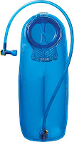
After the mental exercise of figuring out what you can leave behind in one car, while taking the gear you need for the trail in the other, it is time to fill the water bottles and CamelBak - I brought a 100oz CamelBak for my backpack (most packs now have a place to slide in a water bladder - very handy) and two small 16oz Nalgene bottles as backup. They make it easy to measure for cooking water and to have something to mix gatorade.  Also required is a water-filtration system.  The best one around in my opinion is the Katadyn Hiker Pro.  It is easy to use, keep clean, light-weight, and most important, the water tastes fantastic.  It also has fittings to fill the CamelBak and Nalgene bottles.


The next part of the trip was going to be a challenge.  Hikers can contact one of the many shuttle services (Google them as they change too much to supply a link) that will take hikers to the trail head at Mattole Beach so that their cars can be left at the end of the trail - Black Sands Beach.  Be warned it is pricey - around $200 for 2 hikers.  Since we had two cars already, we left the Nissan at the end and took the Kia to Petrolia.  It is a hair raising ride from Shelter Cove to Petrolia to say the least.  It will take about 2 hours to make the trip of 46 miles.  It is a slow tough and rough road - the first 31 miles are up and down - around seemingly endless switchbacks with washed out sections of road.  There are a few homesteads along the way dug into the hillside like ticks on a dogs back - hard living for sure.  The ride can make you car sick if you are prone to that.  But relief can be had at the town of Honeydew.  With 15 miles to go until Petrolia we all needed a break.  Even the poor Kia was starting to smell like hot brake linings and cooked engine oil.  It was here that we met the near-world-famous-almost-record-holding-California-abalone-diver.

Abalone is actually a large sea snail or Gastropod.  The large shoe or foot of the abalone is sought after by divers for its delicious flavor when prepared right, and the shell is often cleaned up and used as an ashtray (such indignity) or nice Mother of Pearl Jewelry.  Of course, people thought the bounty was endless, so the abalone have been over-harvested. Now there are restrictions on harvest dates, types, harvest technique and size.  All good for the abalone to recover, so I am for it.  But we encountered this ne'er-do-well abalone diver with his other buddies at the Honeydew general store boasting that he "almost" had the world record for an abalone.  He said it was 11 inches across and he only needed another inch or so to have the record.  Uh huh.  As I went into the store it sounded like he was telling the next customer who pulled in the same story.

Aaron Bassler on left - with curly wig and glasses on right
Honeydew - Bridge over Mattole River
The remaining 15 miles was not bad at all - the road follows the Mattole river valley to Petrolia.  I had to admit that I was pretty excited about seeing Petrolia.  It was the little town that started this whole thing.  The guys at this point seemed anxious to get going on the hike.  I was too.

Upon arriving in Petrolia we took a drive through the town.  It wasn't exactly like I thought it would be - it was smaller and seemed farther from the ocean than it appeared on maps and satellite images, but it was still cool.  There is a general store, post office and a very sad little gas pump that was neither digital nor equipped to handle the current price of fuel.  Charming to say the least.  We did not stop - I planned to stop in the store when we pick up the car - many days from now. 

Mattole Beach Parking Area

Whitey checking us in at trail head- map to left
We parked the car and unloaded our gear. To me the packs seem like they got heavier on the road to this place.  Just excitement I guess.  I looked around at the hillsides that fall into the Pacific ocean.  The dry grasses painted them tan and the green brush, shaped by the wind, added a dash of color.  Just fantastic.  The wind had picked up quite a bit from Shelter Cove and the air was still very cool.  High 50s or 60s - great hiking weather.  Whitey checked us in so they could notify next of kin if something got us - something nearly killed one of us the next day.  Then we posed for a picture, checked the car once more, and headed off down the coast.  It was incredible to realize a dream.  I was giddy with adventure - my camera was in my hand to capture the entire hike - so you may get to read less of my banter and see more of what we saw.  Be sure to click on the pictures to enlarge.
And off we go......


Inn of the Lost Coast Web Cam pic - what a sunset!!


Next - Lost Coast Trail - Day 1 - Mattole Beach to Punta Gorda Light

Part 8 - The Lost Coast Trail - Day 1 - Mattole Beach to Punta Gorda Light

Hike route for post - pics (red dots)
START HERE - THE LOST COAST PART 1

... continued from part 7

As we left the parking lot and hit the trail, it struck me that I had not been back to a beach on the Pacific Ocean for over 25 years - this caused a sort of breathlessness for me.  As a kid we went to the beach quite often and it was one of those things you got used to doing and didn’t think much about it – it was always present in my life.  I reminisced, as I am prone to do, about RAT beach from my youth.  RAT stood for Right After Torrance and it butted up against Palos Verdes (PV), CA where we lived.  It had a good wave break for my red and blue raft, cold water, nice sand and the occasional tar ball stucking to my feet (Dad would use turpentine to remove them after we got home – this was naturally occurring tar that seeped out of the rocks around PV).  I loved the beach then and I love it now – only now I have 45lbs on my back and I am wearing hiking boots ill-suited for sand.  But the smell of the ocean and hearing the powerful surf breaking was soothing – just what I came here for.  There was also lots of decomposing kelp whips and leaves that had washed up giving the air a slightly sour fragrant smell (It was just as I remembered).  Of course they looked like eels or giant spermatozoa that washed ashore from a horrifically large sea monster - the Gargantuas maybe.   Occasionally one of us would trip or stumble on one adding to the humor.

Whitey took the point, Flyrod was next and I followed at the back (stayed this way the entire hike - natural order of things) – I liked to dawdle along and didn’t want to hold anyone up.  Each one of us was alone in our own space, able to connect with nature or ourselves.  Our goal for the day was to reach Randall Creek for night one.  It was 8.8 miles away – easily reached before dark and before the high tide made a section past Punta Gorda Light impassible.  We felt good and were having fun.
The first couple miles of the trail is on the beach – in the sand and yes rather difficult to walk on.  The curious thing about this sand is that it is round.  Let me explain – the grains of sand do not have sharp edges that lock into the grain of sand next to them.  They just roll past each other as pressure is applied by a hiking boot.  There is no sweet spot of damp compacted sand near the shore that makes it easier to walk - so you just plow through.
North - Cape Medocino
Ocean Power - BOOM!
Flyrod, Jagman, Whitey - no pain yet.
To the North, jutting out into the Pacific is Cape Mendocino (click any photo to enlarge)– the farthest point West in the continental US.  It gives California that distinctive curve to the North at the top of the state.  The 2273ft high Mt. Blank is the large mountain just to the right with a touch of green near the top.  There is an annual 100 mile bike race from Ferndale, CA – the Tour of the Unknown - that includes a climb up the ridge of Cape Mendocino, the next hill over from Mt. Blank, affectionately called the Wall.  It has an 18-22% grade - maybe some other time.
Flyrod
Windy Point - 823ft
Whitey - Punta Gorda -516ft
Thankfully there are some points of the trail that give the wobbly ankles a break as the trail moves up to compacted dunes that are much easier to walk on.  There are some truly impressive hills that seemingly grow out of the ocean - Windy Point was perhaps my favorite up to this point.  It rose into the deep blue sky and guarded this stretch of the beach - making me feel very small.  Apparently there is a road, Windy Point Road (clever), that goes to the top of this hill.  The view must be fantastic- it certainly was from below.  Punta Gorda up ahead is a notorious point for shipwrecks (St Paul - steamer -1905) back before we had the reliable engines and navigation aids that mariners enjoy today.  A lighthouse was built but was decommissioned in 1951.  Now it makes a great stopping point for pictures and lunch.

Tide Pool
Tide Pools and Punta Gorda Light
Incoming tide and CA Brown Pelican
Fourmile Creek -cross at log                         
Punta Gorda Light  - Whitey & Flyrod   
Angry Pacific - windy off the point -the windshear line is visible in distance
One the greatest things about West coast beaches are the abundance of tides pools.  As a kid I just loved climbing around the pools found at Point Fermin near the Carbrillo Marine Aquarium where my mother volunteered.  It seemed so magical that all these creatures would live in sequestration until the incoming tide freed some of them or flushed in new visitors (food) for the more stationary anemones and mussels. There are some exceptional tide pools around the Punta Gorda Light - so take some time to peak inside them to see what is waiting.  Watch for the rogue waves!!


What is impassible at high tide?
Artsy shot - blue was outrageous
Poor lonely lighthouse keeper - me
After an exciting lunch - tuna package with relish, pita bread and a cliff bar - we loaded the packs back on and returned to the task at hand - 5.1 miles to go before setting up camp for the night.  The temperature rose quite a bit after heading slightly Southeast from Punta Gorda.  We were now on the leeward side of the point so the cooling effect of the Northerly wind was diminished significantly.  This would be the pattern for the next couple days - but yeah no rain - great temps - it was perfect weather!

Inn of the Lost Coast web cam pic.

 Up next - Part 9 - The Lost Coast Trail - Day 1 - Punta Gorda Light to...