Wednesday, July 24, 2013

The Teton Crest Trail - Wyoming - Part 1 - The Gang Returns

NOTE: Click any picture to enlarge.

It had a been a couple of years since our last big hike - the Lost Coast Trail - so the gang decided we should do something about it before life gets in the way again.  We recruited some new blood, Brian, to the team who was a former co-worker of Whitey and I and a fellow gearhead; Honda/Acura mechanic.  I guess I can let that go being a British Car mechanic.  Since Brian did not have a trail name like the rest of us, I gave him the name Sugar.

Brain is a Type 1 Diabetic so, PC be damned, I decided to call him Sugar in honor of what my Grandmother would often say, "Well you know that lady has the sugar."  I later learned it was because that lady was diabetic.  I thought it was fitting.  It also shows that people with the disease can do anything the rest of us can and Brian certainly did not let it slow him down.  Kudos to him.
Whitey, Sugar, Flyrod, and Jagman - July 2013
So now where do we go?  So many cool places.  Whitey invited us over for a planning session at his house with homemade Lasagna and beers.  He then produced for us a huge stack of his coveted Backpacker magazines, rife with ideas and places.  The excitement of looking at the glossy pictures of wondrous and wild places, reminded me of a similar time when I was a kid and a friend of mine produced a similarly sized stack of Playboys he acquired from somewhere ( I never learned who had lost their collection).   The wonder and amazement then was similar to now.

Ideas such as Glacier National Park in Montana - awesome sights.  Zion, spectacular and recommended by Whitey who had been there before.  Or the Boundary Waters in MN - we could carry our gear in canoes rather than on our backs; that had some appeal.  Mt Whitney in CA - the highest peak in the lower 48 at 14,505 feet was appealing - except due to overcrowding you had to haul out your own shit in special bags - "WAG Bags" (Waste Alleviation and Gelling).  That moved Mt Whitney down the list.

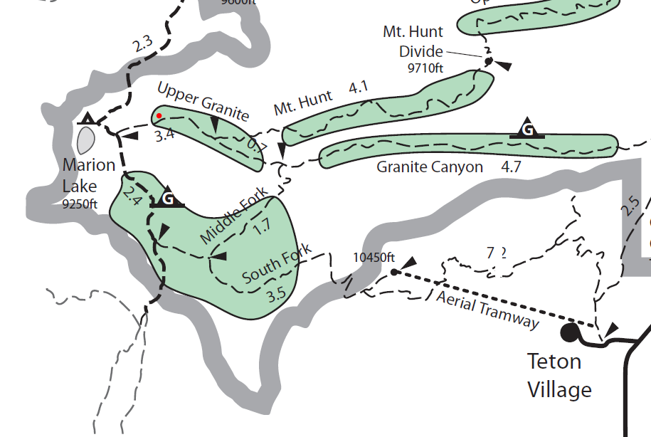
What ultimately rose to the top after some debate was the Teton Crest Trail in the Grand Teton National Park.  This was a 40 mile trail that traversed the wilderness behind the Teton Range and down the rugged canyons.  Places pastey sticky tourists in their minivans would never see.  There were some amazing pictures of sights along the trail plus pictures of the iconic Wyoming mountains known as the Grand Tetons.  Loosely translated from French - means the Big Tits.  So you see I have come full circle.


The Teton Range - running roughly North to South.
This range of mountains, 3 Tetons - South(12,514ft), Middle (12,804ft), and Grand (13,770ft) plus Mount Owen (12,928ft) is perhaps the most photographed range of mountains in the world; the cathedral grouping.  They have such an incredible prominence as they rise from the valley floor that you can't help but stare at them when you get off the plane.  Wells Fargo has a great commercial with one of their six-horse stagecoaches racing along beneath the range.  So very real, and so very the wild west - yippee ki-yay mother #$%@&.  We had to go.


Grand Teton - 13,770 ft.

In early February, as soon as the ranger station was open, Whitey secured our trip with a Grand Teton National Park Wilderness Permit.  We planned to arrive in July - when the weather would be ideal and the snow over some of the passes would be clear.  This permit is required if you are going to stay at the designated camp zones in the park.

Ticket to ride!!!

Tough looking bunch!!

As soon as we got off the plane, I could tell we were at some elevation. (6,451 feet).  I immediately felt lightheaded and was happy we would acclimate for a couple of days - get our feet under us.  We would go up from here another 4,500 feet on the trail. Yikes.

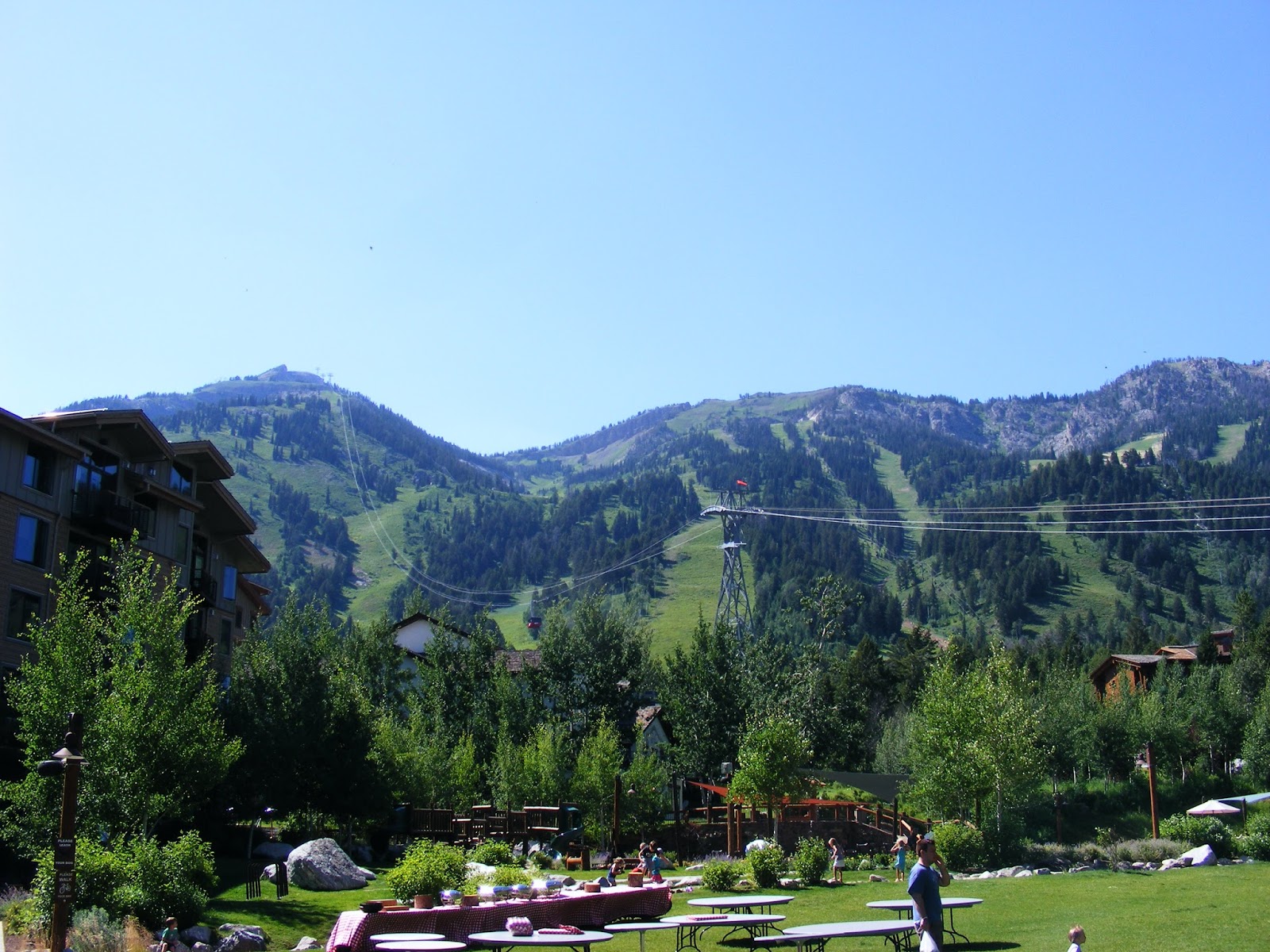
We were staying at a very nice cabin on the Snake River as we got use to the elevation.  It was at a KOA campground and it had everything we needed to "rough it."

Flyrod - playing with his fly rod.
Whitey capturing the moment - note the return of the Orange Crocs - legendary!!

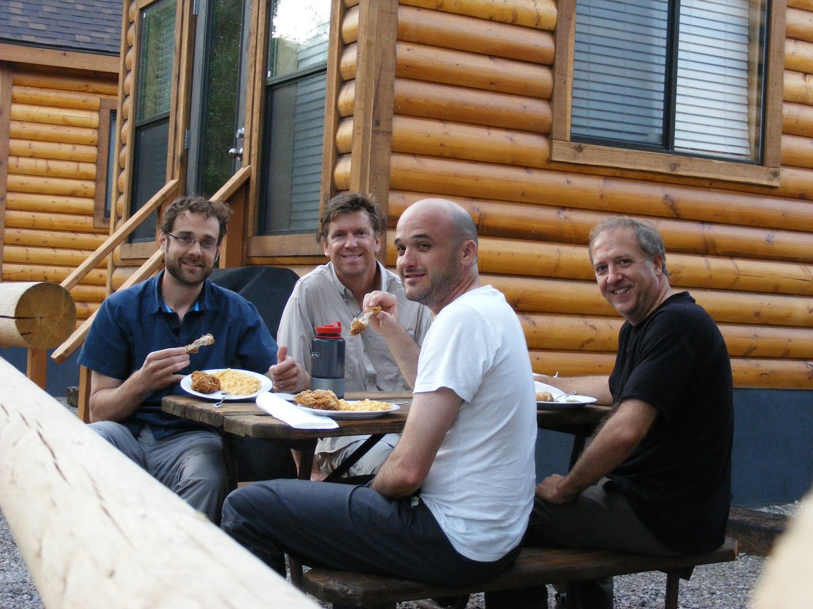
Fried Chicken and Mac & Cheese


Go here next - Teton Crest Trail - Part 2 

The Teton Crest Trail - Wyoming - Part 2 - About town

Click here for prior post.

NOTE: Click any picture to enlarge. 

Since we did not have to hike for at least two days as we acclimated to the elevation - it gave us time to explore the town and area.  We picked up our back-country permits and a couple of bear canisters at the Craig Thomas Discovery Center in Moose, WY.  The bear canisters are required - you are not allowed to hike without them; for your protection and the bear.  A nuisance bear who associates humans with food will not likely be around for long. 

We also located some stove fuel and bear spray (also required) at an outdoors supply store - not so sure if the spray would stop a Grizzly (Ursus arctos horribilis) - correctly called a brown bear by scientists - but we hoped.  The great explorers Lewis and Clark are credited with the name Grizzly - thought because of its haggard grizzled coloring and temperament.   The name Grizzly has stuck ever since.  I am thinking the peppery bear spray may make you taste a bit better than someone without the spray; spicier hikers to the bland doughy folks without bear spray.  With about 600 Grizzlies in the area - we wanted needed to be sure.

 Bronze Moose at the Craig Thomas Discovery Center in Moose, Wyoming.
Kayak looks so small on Jenny Lake - Cascade Canyon in background.
Coolest scooter I have ever seen.  Not a Vespa - but a newer knock-off.
Great use for old skis. 


Whitey with his Arnold Palmer.
Walking about town was a lot of fun too.  There was an amazing art/craft show - at Miller Park.  This was not the folksy crafts that seem to be rampant on the east coast - teddy bears, knitted mittens, and other tchotchke.  This was quality craftsmanship - with metal, stone and fire!!  Loved it.  Manly like the west should be.  Speaking of manly - Flyrod had to take a conference call and we ended up finding him in the Silver Dollar Bar at the gorgeous Wort Hotel.

Silver Dollar Bar and Grill at the Wort Hotel - Jackson, WY
We checked out Jackson Hole Ski Resort at the Teton Village as this would be where we leave from the next day.  There was tons of activity - Para-gliders coming down from the top of the mountain, people arriving for dinner to take a gondola ride to a restaurant half way up the mountain, and of course the Mangy Moose Bar and Grill for some suds.  I had been to this resort when I was I think in the 5th grade - my father was in town for a conference and he took me and my sisters to the Mangy Moose for dinner.  I remember seeing an airplane cabled to the ceiling and was happy to find it was still there.

We headed back into town for some pizza at Pizzeria Caldera  and we all enjoyed a delightful show from the upstairs outdoor balcony.  The beautiful people abound in Jackson - I think it is the elevation.  We were thrilled to see a fantastic looking cowgirl who not only parallel parked (a lost art) her pickup truck on West Broadway, but she also stepped out wearing a nice short denim skirt and cowboy boots.  But wait it gets better - she then smoothly hopped over the railing next to the street up onto the boardwalk- so sexy.  It was the dessert for a great day.  And yes, I really need to get out more. 

There is the plane - hanging from the ceiling at the Mangy Moose.
Follow the cables to the top and that is where we will start our hike.


The new tram that will take us on our hike.
You just don't see an old AMC Eagle everyday.  Great shape.
Jackson Hole Ski Resort

People take the tram to the top - then jump off.  Great ride down.


Go here next - Teton Crest Trail - Part 3

or back to beginning - Teton Crest Trail - Part 1

The Teton Crest Trail - Wyoming - Part 3 - Start - Day 1 - Rendezvous!

Click here for prior post.  

NOTE: Click any picture to enlarge. 


Goal for Day 1 - Top of tram to our designated Granite Canyon camp - red dot.
Our planned hike the first day was not very ambitious - about 5 miles.  We took the Jackson Hole Resort Tram up to the top of Rendezvous Mountain to find the Rendezvous Mountain trail that will connect to the Middle Fork Cut Off spur trail; this would hook up with the Teton Crest Trail (TCT).  Whew!! Easier than it sounds.  The official trail head for the TCT is Teton Pass off of RT22 to the south.  What we did is a common "cheat" to get to the TCT quickly.  We did not feel bad about it at all.  Great ride to the top.

The National Park service offers a great map and additional information for the Teton Crest Trail and other trails within the Grand Teton Park.  This is key to your planning.
Google Earth Image - red dot to right to red dot left - Camp 1
Our gear - Flyrod is carb loading.
Our Chariot to the top.
We look good!!!
Tram makes quick work of gaining elevation
The building at the end of the road is a restaurant - great views.

Flyrod - "So I should use a dry fly up here?"

Lewis and Clark impression

Ready to go - Rendezvous Mountain.  10,450 ft.

Go here next - Teton Crest Trail -Part 4

or back to beginning - Teton Crest Trail - Part 1


The Teton Crest Trail - Wyoming - Part 4 - Day 1 - Rendezvous Mtn to Granite Canyon

Click here for prior post.

NOTE: Click any picture to enlarge.  

Heading down from Rendezvous Mtn was a somewhat easy walk into the valley.  At this point the trail was a gentle slope down to the tree line and creeks.  The people that rode up on the tram stayed behind for some waffles at the small snack shack located at the top.  We left them there and disappeared into the wilderness and moonscape of the high mountains.  The weather was perfect and it was easy to get lost in thoughts with the incredible vistas.

The first camp was only about 5 miles away - but it would still require some ups and downs.  Seeing the trail we would take snake off into the distant valley was a nice preview of the adventure that lie ahead; life should be so foretelling.
The mountains are making us look small
There is the trail down below - snaking into the wilderness.
Heading down

Getting there.
Whitey
Snack time - Whitey and Flyrod keeping us on track.


Stunning walk through the wildflowers that grow in the meadows under the trees
Whitey the "Flower Child"
Intersection with the Teton Crest Trail - we are now on the TCT!
Based on this sign we only had a couple miles left until camp - our camp is near Marion Lake - we do some backtracking to get to our spot - but it is maybe 2.5 miles from here.  So far it is a very enjoyable hike and everyone is in great spirits.  The scenery is also second to none.  We are just plodding along, enjoying ourselves.

We did not have a lot of water at the start - so we stopped at a creek crossing and pumped some water into our Camelbaks and Nalgene bottles.  We would pump some more at camp for dinner.  This was pretty standard for our nightly tasks - water for dinner and dishes.

I have to admit that the actual hike was not that difficult, but since it is at 9,000+ feet, it really sucks the air out of you.  Everything takes more time and we deliberately drink more water to prevent any issues.  Dehydration is always a factor backpacking - with abundant water, why not drink.
This is the Middle Fork of Granite Creek - some tasty water!!


Marion Lake is below that large mountain ahead.
Go here next - Teton Crest Trail -Part 5

or back to beginning - Teton Crest Trail - Part 1